c. AD 250 – 900
Farms, causeways and reservoirs
Around 600 an eruption of the Loma Caldera volcano in El Salvador buries the farming village of Joya de Cerén under 4 to 8 m of ash within hours. Its people, perhaps 200, flee, probably in the early evening, and leave their houses, kitchens, storehouses, a sweat bath and their fields as they stand. Ripe maize in the fields dates the eruption to August or September, and beside it grow manioc, agave, cacao and guava. Each household keeps about 70 pots, with obsidian blades, jade from the Sierra de las Minas and fine pottery from Copán obtained by trade.
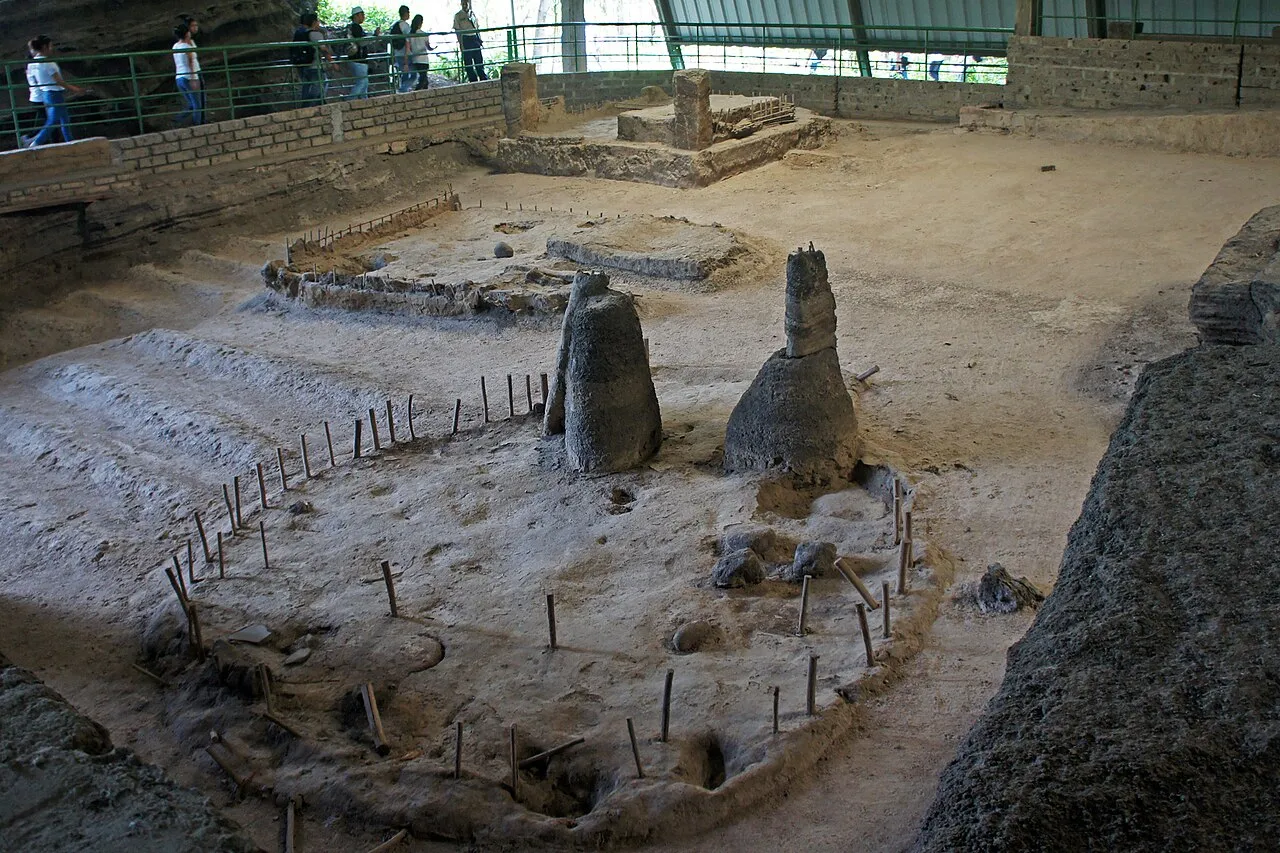 Structures 11, 6 and 1 at Joya de Cerén, a farming village buried by volcanic ash around 600Wikimedia Commons, Mario Roberto Durán Ortiz, CC BY-SA 3.0 (ES Joya Ceren 05 2012 Estructuras 11 y 6 y 1 Area 1 1491.jpg)
Maize, beans and squash are the staples, with chili peppers, tomatoes, cotton, cacao and vanilla. Farmers clear plots in the forest by burning, and where cities grow dense they also terrace hillsides, raise fields between canals in the wetlands and keep gardens around their houses. The Maya keep dogs, and pen wild turkeys to fatten them.
Airborne laser surveys, lidar, see through the forest canopy. At Caracol a survey of 200 km² in 2009 finds eleven new causeways and thousands of house groups set among farming terraces, and in 2018 a survey of 2,100 km² in the north of the Petén maps houses, palaces, raised causeways and fortifications between the cities. Causeways, sacbeob or "white roads", paved with white plaster over a fill of stone, join city centres to their districts and to other towns. One runs about 100 km from Coba west to Yaxuna, and a stone roller of five tons, used to pack its surface, still lies on it.
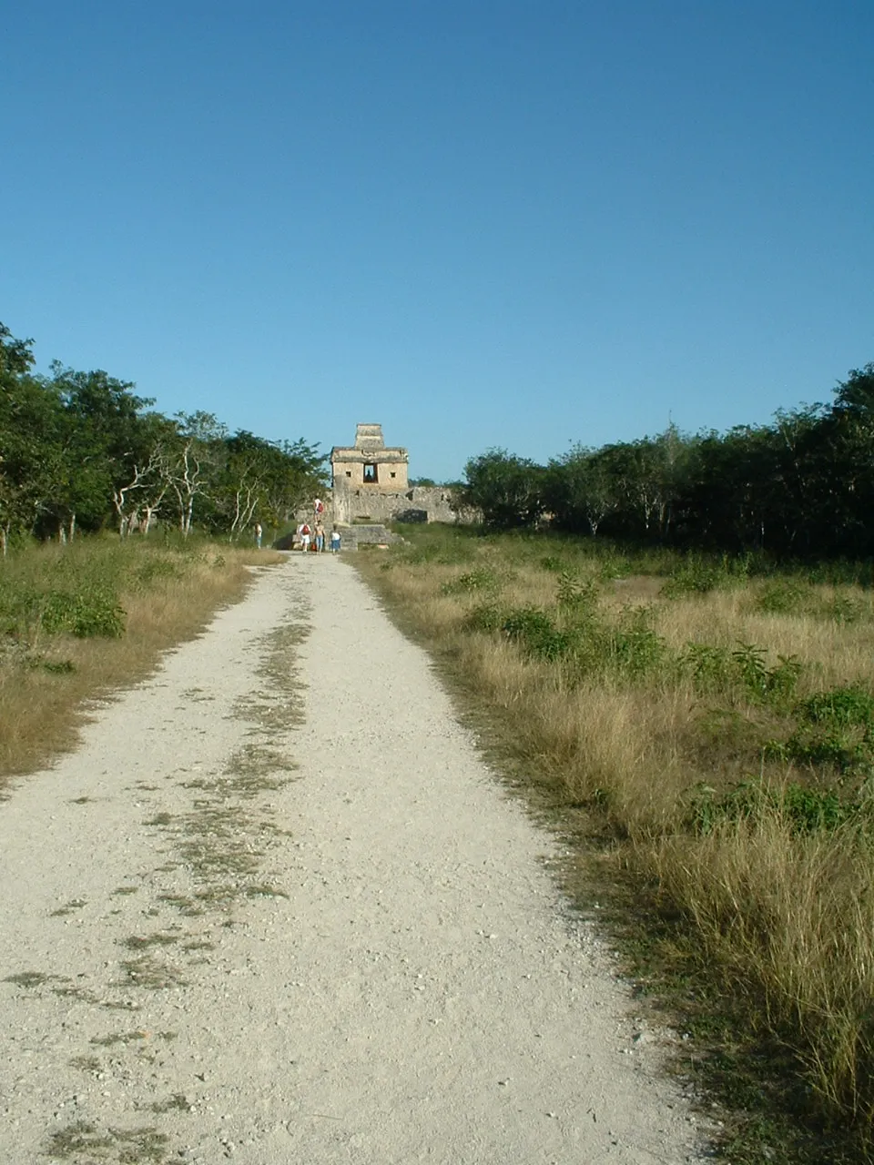 A sacbe, a raised causeway paved white, leading to the Temple of the Seven Dolls at Dzibilchaltun in northern YucatánWikimedia Commons, David Wohl, CC BY-SA 3.0 (Sacbe Dzibilchaltun.jpg)
Tikal has no source of water except rain, which it stores in ten reservoirs. Its plazas are paved with plaster and sloped to send the rain through canals into the reservoirs, and the Corriental reservoir filters its water through sand and zeolite. Calakmul rings its centre of 22 km² with canals and reservoirs that could supply 50,000 to 100,000 people.
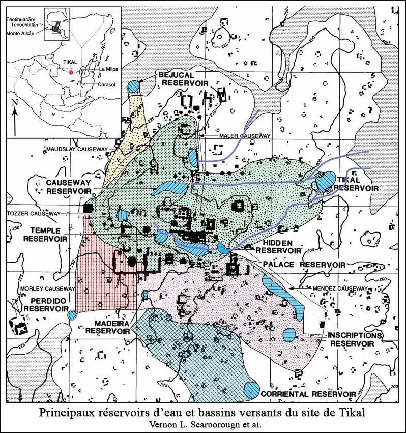 The main reservoirs of Tikal, in blue, with the paved areas that drain into them, plan by Vernon L. Scarborough and othersWikimedia Commons, Vernon L. Scarborough and others, CC0 (Plan des principaux réservoirs d’eau de Tikal.jpg)
Sources
- Payson Sheets, The Cerén Site: A Prehistoric Village Buried by Volcanic Ash in Central America (1992).
- Lynn V. Foster, Handbook to Life in the Ancient Maya World (2002), pp. 310 to 312.
- Arlen F. Chase and Diane Z. Chase, Interpreting the Maya “Collapse”: 2009 Field Report of the Caracol Archaeological Project (2009).
Prev: Gods, temples and the ballgameNext: Jade, obsidian, salt and cacao